Studies: Zion Crossroads Corridor Improvement Study (Routes 15 and 250), Fluvanna & Louisa Counties
Cost and schedule ►

Virtual Public Meeting Feb. 23
The Thomas Jefferson Planning District Commission will hold a virtual public meeting to gather public comment on the corridor study for U.S. 15 through Zion Crossroads.
To attend the meeting click here: https://attendee.gotowebinar.
The online survey for comments is here: https://metroquestsurvey.com/
Study Details
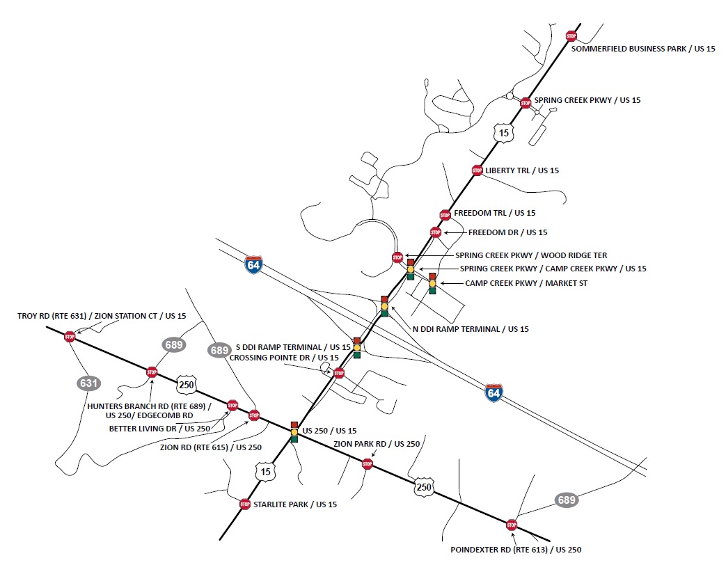
The Zion Crossroads Small Area Study will evaluate automobile, transit, bicycle, and pedestrian conditions along US 15 (James Madison Highway) between Sommerfield Drive and Starlite Park and US 250 (Richmond Road/Three Notch Road) between Zion Station Road and Poindexter Road in Louisa and Fluvanna Counties. The Zion Crossroads area continues to experience population growth and changes to land use and, as such, has experienced increasing safety and operational challenges.
The study vision is for the Zion Crossroads area and associated roadway network to support planned development and provide safe travel for all uses and users of the roadway.
The study will be done in two phases:
- Phase one, which was completed in January 2020, convened a group of stakeholders that identified consensus goals and the scope of the study.
- Phase two will identify the transportation solutions that will help meet the vision and goals of the study.
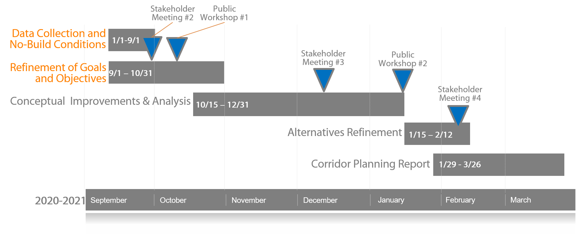
Study Schedule:
Study Goals
- Safety: Improve the anticipated safety performance of the US 15 and US 250 through spot (intersection) and/or systemic (corridor-wide) treatments.
- Traffic Operations: Improve the traffic operations of study intersections within the study limits through the use of innovative intersection control strategies or other improvements.
- Access Management: Improve access management along US 15 and US 250 through the consolidation of access points or the restrictions of particular movements.
- Transit: Assess the potential for the introduction of transit service along the corridor.
This study is supported by a stakeholder group made up of representatives from VDOT, Fluvanna County, Louisa County, and the Thomas Jefferson Planning District Commission (TJPDC).
Benefits
The purpose of the study is to develop short‐, mid‐, and long‐term community‐supported transportation solutions to provide safe travel for all uses and users of the roadway.
Resources
Chuck Proctor, Culpeper District Planning Manager
(540) 829-7558
Other relevant links:
Revised Phase 2 Study Schedule ![]() (67 KB)
(67 KB)
Spring Creek-Camp Creek Alternatives Summary ![]() (1.1 MB)
(1.1 MB)
Potential Roadway Connections within study corridor ![]() (357 KB)
(357 KB)
Corridor Conceptual Designs, Spring Creek Parkway to U.S. 250 ![]() (33.5 MB)
(33.5 MB)
Proposed Multi-Modal Facility Improvements ![]() (364 KB)
(364 KB)
Existing and Future No-Build Condition Report  (13 MB)364 KB)
Corridor Study Map  (241 KB)
Lat/Long: US 250 from 37.976489, - 78.2366 to 37.965189, - 78.203047, and US 15 from 37.966497, - 78.223283 to 37.994483, - 78.198417
Locality:
Fluvanna
and
Louisa


