Major Initiatives: Route 608 (Brooke Road) Maintenance and Operations
Cost and schedule ►
Route 608 (Brooke Road) in Stafford County experiences recurring high water and flooding on a portion of the road that runs parallel to Accokeek Creek, especially in the “S” curve between Raven Road and Maplewood Drive.
Brooke Road is located in a mapped floodplain and sits low near the wetlands associated with Accokeek Creek. This provides little elevation for the water to drain out of the ditches and into local waterways.
Emergency Access Connector
Stafford County is exploring the development of a potential 2-lane roadway, approximately 800 feet in length, between Windermere Drive and Crestwood Lane to provide through-travel access for Brooke Road area residents when the road is closed to traffic during emergencies.
Visit the Stafford County project page to learn more, as well as to learn more about future Brooke Road reconstruction.
VDOT is committed to maintaining Brooke Road to keep it open to the maximum extent possible, and keeping travelers notified of current travel conditions.
This includes:
Drainage Pipe Installation between Raven Road and Maplewood Drive: April 2022
Crews replaced a deteriorated drainage pipe in the "S" curve area, and slightly raised the road's grade to accomodate the new pipe. A water storage basin and pump were also added to reduce the risk of flooding.
Drainage Pipe and Sinkhole Repair: June 2021
Crews addressed a failed drainage pipe near Poplar View Drive that created a small sinkhole in the pavement, which was approximately 1 ft. across.
Beaver Dam Removal in Crow's Nest Natural Area Preserve
In response to customer reports regarding the existence of beaver dams in Crow's Nest Natural Area Preserve, and customer concerns that this may contribute to flooding along Brooke Road, VDOT coordinated with the Virginia Department of Conservation and Recreation (DCR) to obtain right of entry for the U.S. Department of Agriculture (USDA) to access the preserve. The USDA conducted a beaver dam removal effort from December 2020 through March 2021, and removed 15 beaver dams over this time period. VDOT invested $11,000 toward this removal effort.
High Water Advisory and Road Closure Notifications
Emergency response on Brooke Road is part of our mission. VDOT crews monitor conditions during periods of forecasted heavy rain. Signs and barricades are kept ready for quick deployment when high water or flooding has affected travel lanes.
A high water advisory sign means a road is passable with caution, but a portion of the road has standing water. Diamond-shaped, orange "Caution, High Water" signs are placed on both approaches to flood waters. Also, VDOT has positioned a message board near the Andrew Chapel Road intersection advising travelers to use caution due to the potential for high water.
When the road is blocked by flood waters, VDOT crews post orange-and-white striped barricades with the black-and-white "Road Closed" and "Road Closed to Through Traffic" signs at both approaches.
For real-time road conditions on Brooke Road and to check the road’s open or closed status, motorists can check 511virginia.org, or download the free 511Virginia mobile app. Motorists can also call 511 from any phone in Virginia.
Maintaining Drainage Pipes and Ditches
Crews routinely monitor and clear drainage channels along Brooke Road. This includes using heavy equipment, such as vacuum trucks, to remove debris, soil buildup and leaves from drainage pipes.
Pumping of Standing Water
Pumps are used by VDOT crews to remove standing water from Brooke Road in the Accokeek Creek area (in the “S” curve between Raven Road and Maplewood Drive) when flood waters surrounding Brooke Road have receded to a point where the land can receive the water we are pumping off the roadway.
Pumping is not effective when waters surrounding Brooke Road have not yet receded.
Roadside Camera

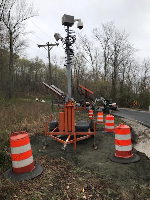
A new portable roadside camera was installed in April 2021 along Brooke Road between Raven Road and Maplewood Drive. VDOT installed the camera at the request of emergency responders to help monitor flooding. A public view of the camera is available on 511virginia.org. Area residents can also check Brooke Road's status on 511virginia.org to see if there are high water advisories or road closures.
Sight Distance Concerns
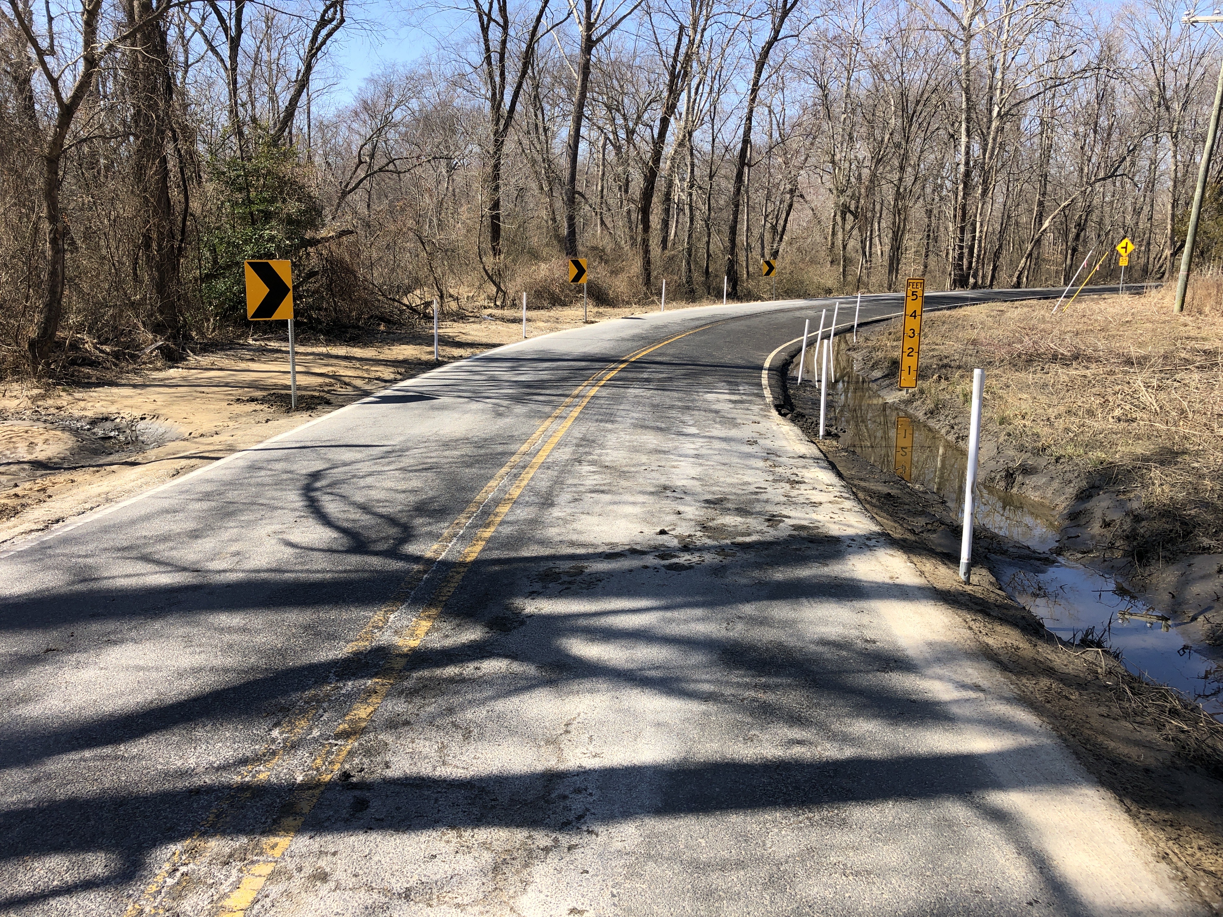
Vegetation is cleared to maintain sight distance at the S-curve area on Brooke Road, where one-way, alternating traffic shares a single lane of traffic when high water is present.
Water Level Markers and Roadway Delineators
To assist with emergency response, VDOT installed water level delineators at the S-curve area on Brooke Road to allow emergency responders to monitor water depth during flooding events.
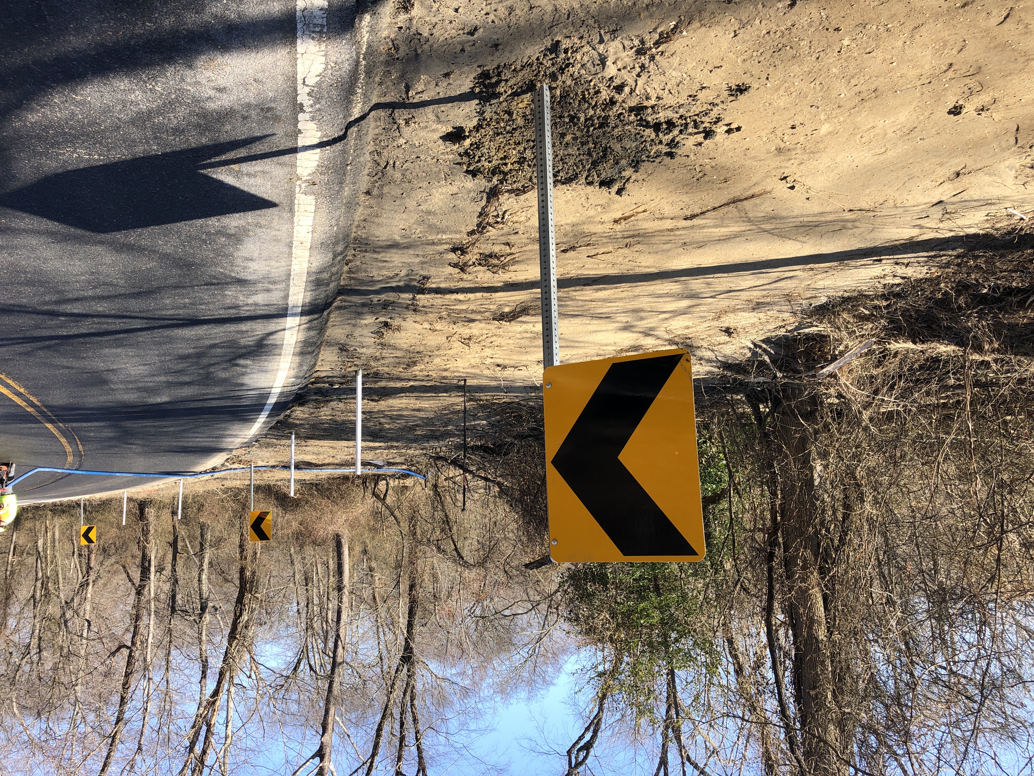
Delineators were placed along the road to define the pavement edge.


Winter Weather Response
During winter, crews monitor weather conditions closely. VDOT crews review forecast information from the National Weather Service and supplementary weather data providers that have specific information, such as air and pavement temperatures.
VDOT crews apply treatment materials on Brooke Road to melt ice and improve traction as needed. This is routinely done on Brooke Road around 4 a.m. on weekdays when slick conditions are anticipated, to stay ahead of peak morning travel times.
Additional Topics
Emergency Declaration
If federal funding is received following a severe weather event to address road damage, it can only be applied to eligible roads. VDOT determines the functional classification of state roads according to federal guidance that takes into account type of trips and expected volume, what systems the roadway connects, and whether the proposed functional classification falls within the mileage percentage thresholds established by the Federal Highway Administration (FHWA). Federal-aid highways generally include interstates, freeways, arterials, and major collector roads. Brooke Road is classified as a Minor Collector through FHWA; thus, not being eligible for federal reimbursement.
Additionally, the designation of an emergency is related to the condition of the road. An emergency constitutes an immediate danger to the public based on the road's condition, such as a total bridge or road washout. In those cases, VDOT has used whatever means necessary to keep traffic from traveling on the affected section of road, such as installing barriers and establishing a detour. Repairs are made to restore the road so it can safely carry traffic. When Brooke Road is closed for flooding, it is a temporary condition. The road itself remains sound. Brooke Road is closed until the water in the floodplain recedes, and we can perform a safety inspection of the road surface. The road is then reopened to traffic.
Benefits
- Routine maintenance of drainage facilities, such as pipes and ditches
- Water pumping when effective (waters in the adjacent Accokeek Creek must have subsided enough to receive water pumped out of the travel lanes)
- Road treatment when inclement weather is forecast
- Snow removal
- Addressing sight distance and vegetation concerns
- Spot-pavement repair, such as filling potholes
- Monitoring high water and road flooding, and posting signs and barricades to notify motorists of high water or road closures
- Updating 511Virginia with real-time road conditions
Resources
Kyle Bates, P.E., Resident Engineer, VDOT Fredericksburg Residency Office
(540) 899-4300 office
Kelly Hannon, VDOT Communications Manager
(540) 656-0321 cell
Major funding source: VDOT Annual Maintenance Budget
Lat/Long: 38.375976, -77.349410
Locality:
Stafford


