Studies
Route 17 Arterial Preservation Plan
Area Maps

April 2020
Est Completion Date
Spring 2023
Lengths and Limits
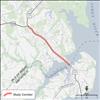
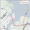
The study area extends from the intersection of Route 258 (Brewers Neck Blvd) in Isle of Wight County to the intersection of College Drive in the City of Suffolk. The study area is 10.5 miles in length.
Contractor
Michael Baker International
Locality
Isle of Wight and Suffolk
District
Hampton Roads
Contact
Hampton Roads Public Information
757-956-3032
Overview
The purpose of an Arterial Preservation Plan is to develop a holistic approach that identifies ways to ensure the safety and preserve the capacity of the Commonwealth’s arterial highway network without wide scale roadway widenings. This Arterial Preservation Plan has been requested to identify investment recommendations that will help preserve and enhance this key transportation corridor due to the important role it plays in the region as significant tourism corridor, a key freight corridor serving the Port of Virginia, and a vital link within the Commonwealth.
Learn more about VDOT's Arterial Preservation Plans here.
Stakeholders
Localities involved in the study include Isle of Wight County and the City of Suffolk, along with the Hampton Roads Transportation Planning Organization and Hampton Roads Transportation Accountability Commission.
Status/Current Activities
The Virginia Department of Transportation (VDOT) sought feedback through a series of online surveys, part of an Arterial Preservation Plan studying ways to enhance safety, preserve capacity and improve mobility on Route 17 in the City of Suffolk and Isle of Wight County, all without large-scale roadway widening.
Following the public feedback periods and with input from impacted municipalities, the study team will refine study recommendations and incorporate them into a final report.
Benefits
This Arterial Preservation Plan has been requested to identify investment recommendations that will help preserve and enhance this key transportation corridor due to the important role it plays in the region as significant tourism corridor, a key freight corridor serving the Port of Virginia, and a vital link within the Commonwealth.
Study Timeline
- A study kickoff meeting was held with stakeholders in June 2020.
- Traffic and crash data collection and field investigation was performed in Summer 2020. Traffic data collected during the COVID-19 pandemic was adjusted based on reference data from before the pandemic.
- An online public survey to gain public insight along the study corridor was conducted in September 2020 which received more than 1,000 responses. The focus of this survey was to gather opinions on travel experiences within the study area between Isle of Wight and the City of Suffolk. Responses were used to supplement a data-driven analysis of existing conditions and inform recommendations to address identified issues.
- The study team developed a forecast of future traffic conditions for the year 2040 based on anticipated growth patterns.
- Potential solutions to issues defined through the existing conditions analysis and survey were tested and discussed by the study team. These concepts can be viewed in the ‘Concept Development Meeting’ document in the Study Documents and Resources section.
- The preferred recommendations for the corridor were further developed with sketches, cost estimates, and anticipated benefits to share with the public in a second survey as noted in the next steps. Draft corridor recommendations are shared in the Study Documents and Resources section.
- A second and third round of public involvement was conducted in early 2022 to gain feedback on the proposed concepts. An online Metroquest survey was open Jan. 17-31, 2022 to collect feedback on recommendations to improve travel conditions in this area. This was the second survey in a series, with this survey focused specifically on the portion of Route 17 from College Drive in the City of Suffolk to the Isle of Wight County line, and respondents were asked to rate and prioritize proposed improvements to this corridor. The third survey created to gather feedback on recommendations to improve travel conditions on Route 17 is focused specifically on the portion of Route 17 in Isle of Wight County, from the Suffolk city line to Route 258 (Brewers Neck Boulevard) in the County was open for participation March 7-21, 2022.
- With public feedback and input from impacted municipalities, the study team will refine study recommendations and incorporate them into a final report.
Study Documents and Resources
- Route 17 Kick-off Meeting - June 2020
- Route 17 Stakeholder Meeting / Existing Conditions & Forecasting Report / Summary of Responses to First Survey – November 2020
- City of Suffolk Draft Recommendations
- Isle of Wight Draft Corridor Recommendations - forthcoming


