Under Construction: Appalachian Trail Bridge Over Route 311 in Roanoke County
Cost and schedule ►
Traffic alerts ►
Public outreach ►
This project currently under development will construct a new pedestrian bridge to carry the Appalachian Trail over Route 311 in Roanoke County.
The McAfee Knob trailhead of the Appalachian National Scenic Trail access is extremely popular with hikers but poses a safety concern as pedestrians entering the trail from the nearby parking lot must cross Route 311 (Catawba Valley Drive) at a location in a curve with limited sight distance.
As a long-term improvement to enhance pedestrian safety, VDOT, in partnership with the National Park Service, the Appalachian Trail Conservancy, Roanoke Appalachian Trail Club, Roanoke County and the Roanoke Valley-Alleghany Regional Commission, pursued plans for a bridge to carry trail users over Route 311 away from vehicular traffic.
The new concrete and steel bridge will be maintained by the National Park Service and will be approximately 90-feet long, eight feet wide and span 17.5 feet above the Route 311 roadway. The new bridge will have clearance similar to an interstate highway which means standard commercial vehicles will be able to pass beneath the structure without restriction.
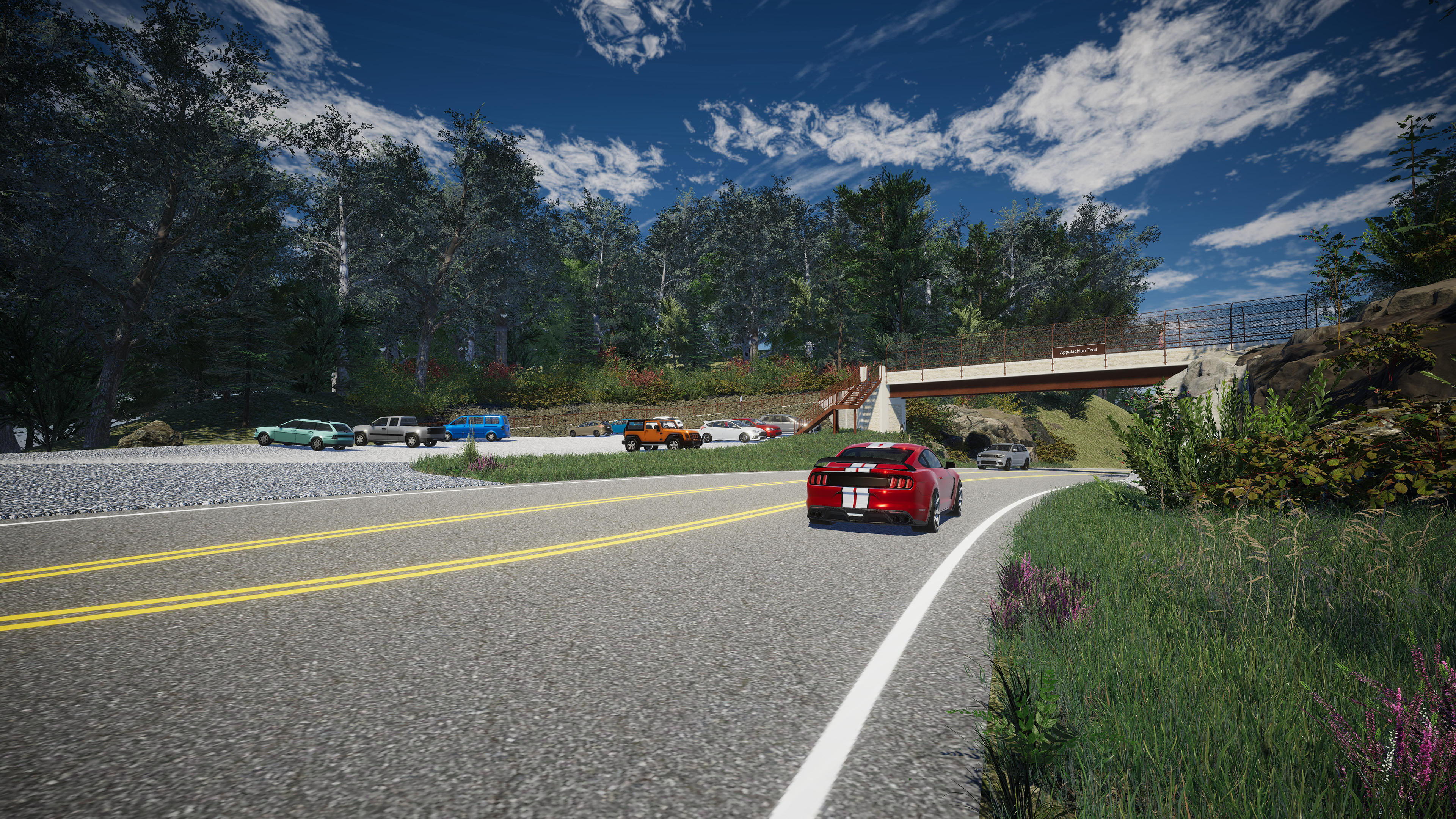
To view additional project renderings of the future bridge, visit the project photos link in the resources section at the bottom of this page.
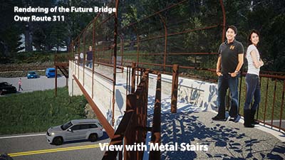
To blend in with the trail’s natural setting, the bridge’s abutments and railing will have concrete architectural treatments with a gray color coating and patterns to simulate rock. The bridge’s weathered steel girders also will provide a rustic look.
Frequently Asked Questions
Why is a new bridge being built?
The new bridge is being built to carry pedestrians over Route 311 away from vehicular traffic. The McAfee Knob trailhead of the Appalachian Trail access is extremely popular with hikers but the location poses a safety concern. Pedestrians entering the trail from the nearby parking lot must cross Route 311 at a location in a curve with limited sight distance where approximately 9,100 vehicles use the road each day. As a long-term improvement to enhance pedestrian safety, VDOT, in partnership with the National Park Service, the Appalachian Trail Conservancy, Roanoke County and the Roanoke Valley-Alleghany Regional Commission, pursued plans for a new bridge.
Who has been involved in developing the project?
A planning committee was formed in 2017 to help VDOT develop the project and give input into the design. Committee members include representatives from the National Park Service, the Appalachian Trail Conservancy, Roanoke Appalachian Trail Club, Roanoke County, Roanoke Valley-Alleghany Regional Commission, the Virginia Tourism Corporation, Visit Virginia's Blue Ridge and the Roanoke Regional Partnership. The committee meets three to four times a year.
What will the bridge look like?
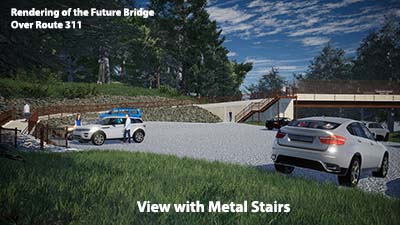
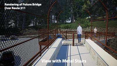
The new pedestrian bridge will be approximately 90-feet long, eight feet wide and span 17.5 feet above the Route 311 roadway. The National Park Service has provided input into the bridge's appearance so that it will blend in with the Appalachian Trail’s natural setting. The bridge’s abutments and railing will have concrete architectural treatments with a gray color coating and patterns to simulate rock. The bridge’s weathered steel girders also will provide a rustic look. No lighting will be installed on or around the new bridge to preserve the natural viewshed.
What other features will the bridge have?
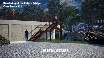
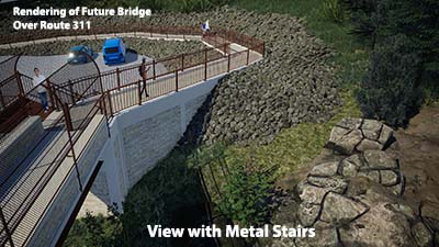
The National Park Service has indicated a preference for metal stairs for ease of future maintenance. A sidewalk ramp will be constructed to allow handicapped access from the parking area onto the bridge. Bollards will be included to prevent motorized vehicle and bicycle access. A brown chain link fence will be installed on the bridge.
Will artwork be included on the new bridge?
The National Park Service and other committee members have provided input into the bridge's appearance that will blend into the natural setting. Artwork and aesthetic treatments are not included in the project.
How was this project funded and when did design start?
The estimated total project cost is $3.2 million. Although a pedestrian bridge had been studied and considered in previous years, federal safety funds for a new bridge were included in VDOT's Six-Year Improvement Program in summer 2017 with project development and design beginning in 2018.
What is the construction schedule?
Construction on the bridge is scheduled to begin in winter/Spring 2024 and be completed in late fall 2024.
What will impacts be during construction?
As VDOT further develops the project, the specific traffic impacts will be determined. Flagging operations will occur daily with occasional short stops to traffic for setting beams. VDOT will avoid peak travel times in scheduling future roadwork. No long-term closure or detour on Route 311 is anticipated. The trailhead parking lot will be closed to visitors during construction. A recreational shuttle service is available from the I-81 exit 140 park and ride lot to access the McAfee Knob trailhead. Reservations are encouraged but walk-up service is also available. Reservations can be made for the shuttle at www.roanokecountyva.gov/2942/McAfee-Knob-Trailhead-Shuttle. Permanent parking capacity will be restored once construction is completed.
How will the Appalachian National Scenic Trail be impacted by this project?
The Appalachian Trail Conservancy and the Roanoke Appalachian Trail Club will realign a portion of the Appalachian Trail to connect to the new bridge and the nearby fire road. Access to the trail will be maintained during construction. Questions regarding the specific alignment and abandonment of the existing trail should be directed to the Appalachian Trail Conservancy.
Will the new bridge limit climbers' access to the nearby rockface?
The rock formations used for climbing will not be impacted during or after construction. Access to the nearby rockface will not be reduced by the completed bridge.
Is expanding the parking area part of the project?
Parking expansion is not a part of VDOT's project to build a new bridge. The National Park Service is responsible for the parking area and is currently conducting a Visitor Use Management Study to evaluate existing parking challenges. Roanoke County is also coordinating efforts with the National Park Service to pursue funding opportunities for potential redesign and expansion of the parking lot.
What else has VDOT done to improve pedestrian safety at this location?
VDOT has installed some safety measures including rumble strips in 2014 and 2018 across Route 311 to attract motorists' attention and flashing pedestrian warning beacons for hikers in early 2018. VDOT also installed No Parking signs on Route 311 and Route 864 (Old Catawba Road) as requested by Roanoke County law enforcement to help reduce pedestrian and vehicle interactions.
Who will be responsible for maintaining the new pedestrian bridge?
Although VDOT will oversee construction of the new bridge, the National Park Service will accept ownership and maintenance responsibilities of the pedestrian bridge into its inventory. The National Park Service will seek funding to support future cyclic maintenance, repair and rehabilitation needs for the pedestrian bridge. The Appalachian Trail Conservancy will be responsible for performing cyclical bridge inspections and supporting the National Park Service to maintain the Pedestrian Bridge and to comply with the applicable ABA accessibility standards, and the Roanoke Appalachian Trail Club will perform vegetation, clearing, litter removal and minor graffiti removal, etc.
Benefits
This project will enhance pedestrian safety by carrying trail users over Route 311 away from vehicular traffic.
Resources
Tony Handy
(276) 627-1505
UPC: 111066
State ID: 0311-080-913, P101, R201, B618
Lat/Long: 37.380514, -80.090250
Locality:
Roanoke


