In Design: Craig Botetourt Scenic Trail
Cost and schedule ►
Traffic alerts ►
Public outreach ►
The Craig Botetourt Scenic Trail, a new trail running through Botetourt and Craig counties, was one of five trails identified by the General Assembly to receive support from an appropriation included in the 2022-2024 biennium budget.
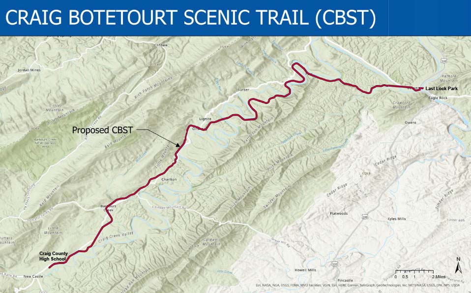
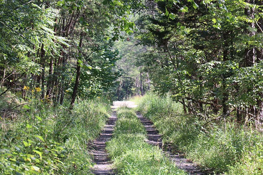
The trail is anticipated to be a multiuse, approximately 10-foot-wide, mostly gravel trail for walking, running, biking, and horseback riding that utilizes a former railbed and some low-volume secondary roads. Approximately nine miles of the 26-mile corridor consist of VDOT maintained secondary roads. Along these low-volume secondary roads, VDOT anticipates that the trail will exist in a “share the road” scenario as is the case today.

Public Information Meeting
A Public Information Meeting was held in Botetourt and Craig Counties in September 2023.
Project Display Boards
Display Board #1
Display Board #2
Display Board #3
Display Board #4
Display Board #5
Display Board #6
Display Board #7
Display Board #8
Location
The new trail will generally parallel Craigs Creek along the former Chesapeake and Ohio (C&O) Craig Valley Branch railbed and right of way between Last Lock Park near Eagle Rock in Botetourt County and Craig County High School near New Castle in Craig County. It will follow the railbed’s alignment with a few relatively short exceptions.

History
The Western Pocahontas Corporation donated the C&O property in 1961 to the Commonwealth of Virginia “for such public use as Commonwealth may determine.” The parcel is roughly 307 acres. The existing width of the old rail line property is mostly 100 feet with a few variations. Over time, approximately nine miles of the 26-mile corridor was converted to VDOT right of way for secondary roads. The entirety of the donated rail line right of way remains under Commonwealth of Virginia ownership.
Funding and Schedule
The Commonwealth Transportation Board in September 2022 authorized up to $1 million dollars to support preconstruction planning activities for the trail. VDOT continues to collect data and conduct site visits and field reviews. The cost estimate is still being refined and a specific schedule for construction has yet to be determined.
Project Development
Although high-level studies for the rail corridor have been conducted in the past, engineering plans for the Craig Botetourt Scenic Trail are still in the early stages of development. Preliminary design is ongoing and many details about the trail have yet to be determined. Both Botetourt and Craig counties have formed citizen committees to assist with the planning phase. The committees have been meeting regularly since December 2022.

________________________________________________________________________________________________
Frequently Asked Questions
Although many details about the project are still being determined, VDOT has provided answers to some of the more frequently asked questions regarding the proposed trail. These answers are based on VDOT’s current understanding of the project. This information may change as the project progresses and more details become available.
Who will maintain the trail?
VDOT will continue to maintain the existing secondary roads that will be a part of the trail corridor. The maintenance and management responsibilities of the remainder of the trail have not been determined at this time.
Who will provide emergency services and police the trail?
Botetourt and Craig counties provide emergency services in those jurisdictions. State and local police would continue to provide law enforcement in those areas as they do today.
What technically is considered a low-volume road?
The American Association of State Highway and Transportation Officials (AASHTO) considers roadways with less than 2,000 vehicles per day (vpd) to be low volume, and roadways with less that 400 vpd to be very low volume.
What are the traffic volumes in vehicles per day (vpd) and speed limits along the secondary route portions of the trail?
On the portions of the old rail line alignment that have been converted to state-maintained routes, VDOT anticipates that the trail will exist in a “share the road” scenario as is the case today.
- Route 686 (Alleghany Circle) (0.3 mile) – Craig Co., 20 vpd - (statutory 55 mph)
- Route 608 (Mill Creek Lane) (0.4 mile) – Craig Co., 25 vpd - (statutory 35 mph)
- Route 817 (Old Rail Road) (3.8 mile) – Botetourt Co., 43 vpd - (statutory 35 mph)
- Route 818 (Craig Valley Drive) (4.1 mile) – Botetourt Co., 64 vpd - (statutory 35 mph)
- Route 685 (Ballpark Road) (0.52 mile) – Botetourt Co., 219 vpd (statutory 55 mph)
What is the past three-year accident history from 4/1/2020 to 3/31/2023 along the secondary route portions of the trail?
- Route 686 (Alleghany Circle) – 0 reported crashes
- Route 608 (Mill Creek Lane) – 0 reported crashes
- Route 817 (Old Rail Road) – 0 reported crashes
- Route 818 (Craig Valley Drive) – 0 reported crashes
- Route 685 (Ballpark Road) – 1 reported crash. This crash involved a vehicle backing into another vehicle that was stopped in the roadway. The crash resulted in property damage only.
Will property owners adjacent to the existing railbed who use it as their only access to their properties be able to continue using it?
VDOT intends to allow adjoining property owners who use the rail corridor as their only access to their properties today, based on their current use, to continue to use it. VDOT will consider a permit process to allow access to continue.
Will the trail be gated?
The trail will likely be gated in select locations to restrict use of unauthorized motorized vehicles. Other gates will restrict access to the general public in locations where private property owners access their property.
How many cars will the trailheads hold?
This is still being evaluated and will vary from trailhead to trailhead and will also be somewhat dependent on the ultimate number of trailheads that will be provided.
Will the trailheads have restrooms and trash receptacles?
The counties are collectively planning to provide and maintain restrooms and trash receptacles at select trailheads.
Can I still hunt on my property if it adjoins the trail?
Hunting on private property would still be allowed. Hunters could not shoot across or from the rail corridor as is the case today. How close to the trail hunters could discharge firearms would be per local ordinances.
Will it be safe for trail users to be on the secondary route portions of the trail?
Pedestrian, bicycle and equestrian use is permitted along all of the proposed secondary route portions of the trail today which are considered low volume roadways. Many of these secondary routes are used today by pedestrians, cyclists and equestrians without known incident. There are similar examples in the Commonwealth including the Roanoke River Greenway and the Potomac Heritage National Scenic Trail, which include sections of both trails and secondary roads. Signage along the secondary routes will alert drivers to the possible presence of trail users on the road.
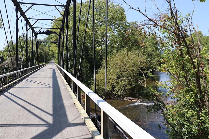
Are the McKalester and Phoenix bridges along state-maintained routes suitable to carry trail users and automotive traffic?
Currently, people use the one-lane bridges along the state-maintained routes by implementing the “take your turn” method to determine who has the right of way to use the bridge at a given time. This same practice would continue. Some signage will likely be included in the project to further guide users as to how they should navigate these bridges.
Will any upgrades be made to the shared secondary routes to better accommodate trail users such as signage, paving, widening or dust control?
Paving and widening of the existing secondary roads is not currently planned. Appropriate signage will be included.
Will people still be able to access cemeteries that are located along the trail?
Access to cemeteries will continue to be provided.
Will the project result in the closure of any US Forest Service roads?
No.
What will become of the high-water route between Oriskany and Route 612 (Scenic View Lane)?
VDOT’s intent is to allow vehicles to use the old rail line south of Oriskany during flooding or high-water events.
Are there any identified environmental concerns?
VDOT’s Salem District Environmental Office has initiated environmental reviews and coordination to obtain information about environmental resources in the project vicinity, to provide natural and historic resource agencies an opportunity to review and comment on the project during its development, and to identify opportunities for avoidance, minimization and mitigation of potential environmental impacts. The project will continue to be coordinated with appropriate federal, state, and local agencies as part of various environmental review processes. All required environmental clearances and permits will be obtained prior to commencement of construction. Strict compliance with all environmental conditions and commitments resulting from regulatory approvals, and implementation of VDOT’s specifications and standard best management practices will protect the environment during construction.
Will the Post Office in Oriskany have to move?
No
Has any of the rail right of way along the project ever been sold by the Commonwealth?
No
Are there any plans to condemn property via eminent domain?
The Commonwealth owns most the land required for the trail; however, additional land and/or easements may be needed in some locations (trailheads, drainage outfalls, etc.). Typically, VDOT uses eminent domain as a last resort if VDOT and the property owner cannot come to an agreement.
Will camping be allowed on the trail?
Camping within the proposed trail boundary is not anticipated.
Will VDOT fence the corridor to keep livestock/pets from entering the trail and to keep trail users on the trail property?
No, VDOT is not planning to fence the corridor. If desired or needed, adjacent property owners would be responsible for fencing their properties.
Why is a trailhead proposed in the Oriskany area?
The Oriskany area is close to the middle of the 26-mile trail corridor, making it an ideal location for people to park. Providing a parking area will allow trail users to have a designated option instead using other public parking alternatives.
Benefits
The benefit of this project is to develop a multi-use trail for walking, running, biking, and horseback riding that utilizes a former railbed and some low-volume secondary roads.
Resources
Lat/Long: 37.667967, -79.856131
Locality:
Botetourt
and
Craig


